Skip to content
✦Unlost WanderingWander freely. Find what you need.

Campground maps & property visualization

See the property clearly. Help guests do the same.

Choose remote map design from your existing materials or a premium on-site project that documents the property firsthand.

Request a campground project quote

What we can create

Useful before arrival and after check-in.

Drone-assisted campground & property mapping

A clearer view of the property—captured and designed for guests.

Unlost Wandering offers professional aerial-assisted mapping and visitor-map design for campgrounds, RV parks, outdoor resorts, and other properties.

From aerial imagery to useful deliverables

As an FAA Part 107-certificated remote pilot, I can capture aerial imagery of your property and use it to develop detailed, visually appealing maps for guest navigation, websites, social media, and printed materials.

Travel and site-visit expenses are quoted separately.

Request an aerial mapping quote
  • On-site aerial photography
  • Property layout documentation
  • Custom visitor-map design
  • Digital and print-ready deliverables

Remote or on site

Match the research to the property.

Some projects already have solid source material. Others need someone to walk the roads, see the layout, and document what visitors will actually encounter.

Customer-supplied sources

Remote Map Design

Custom quote

A visitor map created from your existing diagrams, photographs, sketches, satellite references, and verified property information.

  • No site visit required
  • Branded guest-facing design
  • Web and print-ready formats

Premium property visit

On-Site Visualization

Project fee + travel

Firsthand property documentation for layouts that are difficult to understand from old maps or scattered reference material.

  • Roads, sites, facilities, and landmarks
  • Photography and field notes
  • Aerial documentation when lawfully available

One connected package

Map + Website

Custom quote

A guest-ready property map integrated into a modern campground or RV-park website.

  • Consistent visual identity
  • Mobile-friendly property information
  • Booking links, amenities, and visitor guidance

Original demonstration portfolio

Four ways to show a property.

These are fictional concept projects demonstrating illustrated and realistic property visualization—not completed client work.

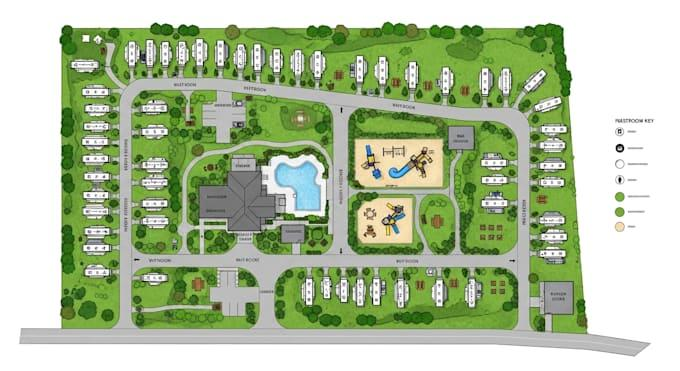
Detailed overhead resort plan showing perimeter and interior RV sites, connected roads, recreation areas, central facilities, green space, and a map key
Fictional concept project

Full-Service RV Resort Layout

A detailed property-wide resort concept with connected roads, varied RV-site arrangements, central guest facilities, recreation areas, landscaping, and a visual key.

Demonstration only. Not a real property, survey, engineering plan, or navigational reference.

View full-size image
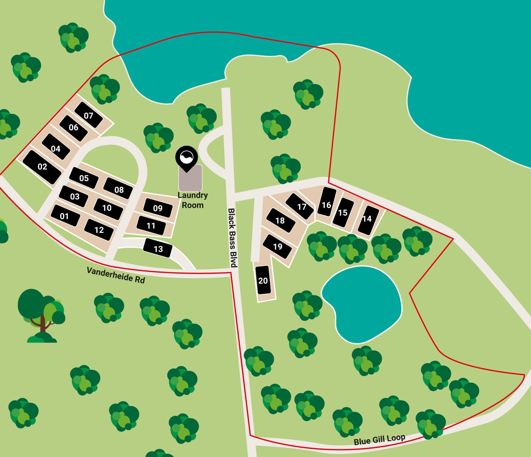
Lakeside campground concept showing 20 numbered sites, road access, property boundaries, laundry, water features, and surrounding vegetation
Fictional concept project

Lakeside Campground Site Plan

A focused lakeside site plan showing numbered pads, their relationship to nearby roads, a central laundry facility, water features, vegetation, and the property boundary.

Illustrative demonstration only. Not a real property, not to scale, and not suitable for navigation.

View full-size image
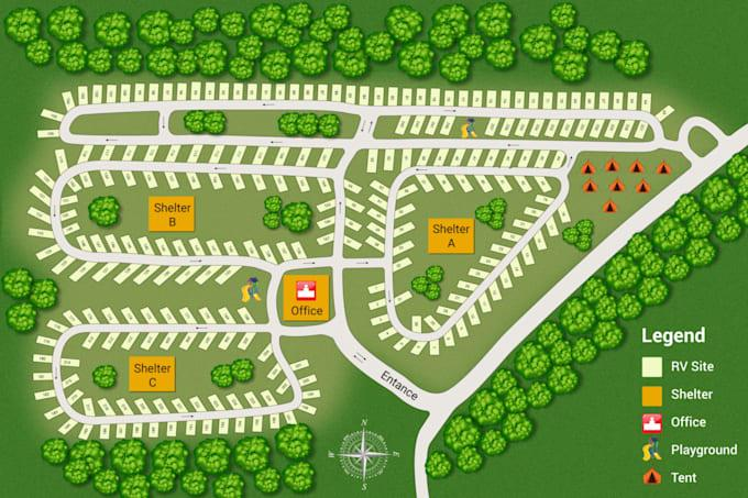
Forest campground concept showing multiple connected loops, RV sites, tent camping, shelters, an office, playgrounds, entrance, legend, and north arrow
Fictional concept project

Multi-Loop Forest Campground

A larger multi-loop campground concept showing the entrance, internal circulation, RV and tent areas, three shelters, office, playgrounds, landscape buffers, and a clear legend.

Demonstration only. Locations, distances, travel times, and route geometry are fictional and not navigational references.

View full-size image
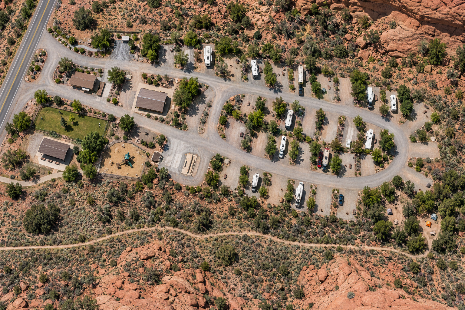
Realistic fictional aerial visualization of a high-desert RV campground with internal roads, RV sites, central buildings, recreation areas, tent sites, surrounding rock formations, and highway access
Fictional concept project

High-Desert Aerial Campground Layout

A realistic aerial-style property visualization showing road circulation, occupied and open RV pads, central facilities, recreation areas, tent sites, highway access, vegetation, and surrounding terrain.

Visualization demonstration only. Not a real property, completed client project, survey, engineering document, or navigational reference.

View full-size image

Have a real property or visitor area?

Let’s turn your source information into something guests can actually use.

Request a map quote

Start the conversation

What does your property need?

You do not need to know exactly which service fits. Tell me what you know and we can sort out the next step.

Your message is protected by Cloudflare Turnstile. No newsletter signup is attached to this form.